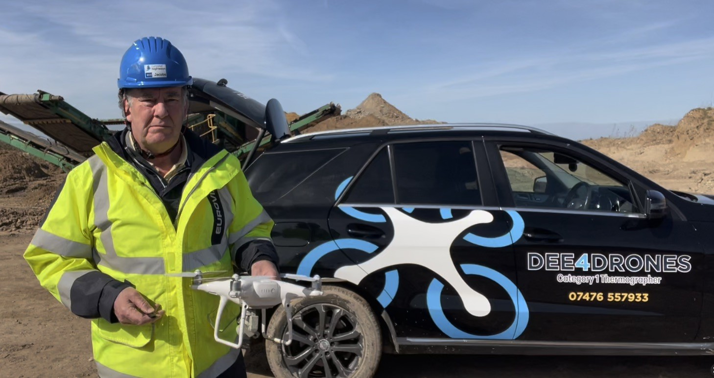
By Richard Dee
•
October 20, 2025
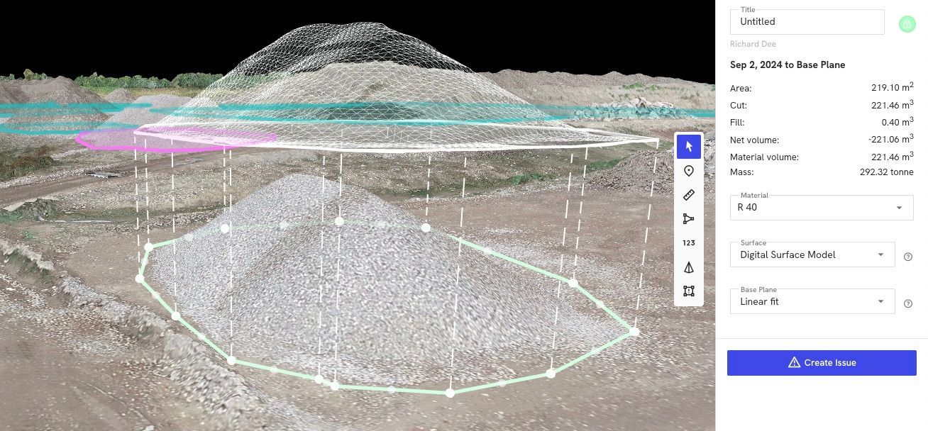
October and November in Yorkshire brings two certainties: shorter days and quieter bookings. This year, there's a third: budget uncertainty that's making potential guests think twice about their spending. Pub landlords across Sheffield, Leeds, and Bradford are watching footfall drop. Restaurant owners see fewer advance bookings. Hotel managers notice guests delaying their weekend breaks until after Chancellor Rachel Reeves delivers her budget on 26th November. Consumer confidence is shaky, with families worried about potential tax changes and rising costs. Meanwhile, daylight disappears by 4pm, making your venue's cosy interior invisible to passing trade. That warm, welcoming atmosphere you've worked so hard to create? Hidden behind dark windows and November drizzle. But here's what smart hospitality operators are discovering: whilst others wait for better conditions, Matterport 3D virtual tours are turning these twin challenges into their biggest booking opportunity of the year . The Perfect Storm Creating Perfect Opportunities The hospitality sector is feeling the squeeze. Consumers are being more selective about where they spend their money, especially on discretionary visits like meals out, weekend breaks, or family celebrations. They want to be absolutely certain they're choosing the right venue before they commit. Add Yorkshire's winter weather to the mix. Nobody wants to drive across town to check out a restaurant, only to find it's not what they expected. Families planning caravan holidays want to see exactly what they're booking before putting down a deposit. Wedding parties need to visualise their special day venue without multiple site visits. Traditional hospitality marketing, a few photos on your website and hoping for the best isn't cutting through the noise anymore. This is exactly where 3D virtual tours shine brightest. Why Matterport 3D Tours Solve Both Problems Simultaneously Problem 1: Budget Uncertainty Makes Guests More Selective Solution: Virtual tours let potential guests explore your venue thoroughly before making any commitment. They can see exactly what they're paying for, building confidence in their booking decision. A family in Harrogate can spend 15 minutes exploring every corner of your Lake District lodge from their living room. They'll see the kitchen facilities, check the bedroom layouts, and get a feel for the outdoor spaces. When they do book, they're already excited about their stay. Problem 2: Dark Winter Evenings Hide Your Venue's Appeal Solution: 3D tours capture your venue in perfect lighting conditions. Every room looks warm, inviting, and atmospheric – regardless of when potential guests view it online. That cosy pub snug in York looks perfect at 2pm on a sunny October day when you capture the tour. Guests can experience that same welcoming feeling at 8pm on a rainy Tuesday in November, when they're planning their weekend out. The Competitive Advantage Hidden in Plain Sight Whilst your competitors wait for market conditions to improve, you can be winning bookings and building customer confidence . Here's what's happening right now: Venues without virtual tours are telling potential guests: "Come and have a look around if you're passing." But nobody's "just passing" in November rain. Venues with Matterport tours are saying: "Explore our entire venue online right now. See exactly what we offer before you travel. Book with complete confidence." Which approach would you choose as a customer? Real Results in Challenging Markets Hospitality venues with 3D virtual tours are seeing: 67% more time spent on their website compared to photo-only listings 43% increase in direct bookings (bypassing commission-heavy booking platforms) 38% reduction in booking enquiries that don't convert (guests self-qualify better) 52% of viewers return to explore the tour multiple times before booking But here's the game-changer: you get detailed analytics showing exactly who's engaging with your venue. The Data That Drives Better Business Decisions Every virtual tour comes with comprehensive analytics including: Unique visitor data with email addresses of new prospects Time spent in each area of your venue - which spaces attract most interest? Return visitor patterns how many times do guests explore before booking? Geographic data showing where your online visitors are coming from Peak viewing times when are people most likely to explore your venue online? This isn't just marketing it's market research delivered automatically. You'll know which areas of your venue are most appealing, which features guests spend longest examining, and exactly who's considering your venue for their next visit. More importantly, they're maintaining booking interest even when footfall drops. Guests bookmark venues with good virtual tours, returning to show family members and plan their visit in detail. The Technical Magic That Creates Emotional Connection Matterport's technology captures more than just 360-degree photos. It creates a true-to-life spatial experience that static images can't match. Potential guests can: Walk through your venue naturally , understanding the layout and atmosphere Measure spaces accurately for private events and group bookings Experience your venue's character and ambience realistically Explore at their own pace , spending time in areas that interest them most Share the experience with family and friends who'll be joining them Showcase Your Unique Selling Points Like Never Before Traditional photos can't capture what makes your venue special. 3D virtual tours let you highlight: Accessibility Features: Step-free access routes clearly visible Accessible toilet facilities and their locations Wheelchair-friendly table arrangements Hearing loop areas and quiet spaces Accessible parking proximity Unique Amenities: Historic features and architectural details Outdoor spaces and beer gardens Private dining areas and function rooms Children's play areas and family facilities Specialist equipment (stages, dance floors, AV systems) Atmosphere and Character: Cosy fireplaces and intimate seating areas Views from different tables and rooms Natural lighting throughout the day Space flow for events and celebrations Hidden gems that photos miss This isn't just convenient, it's emotionally engaging. Guests start imagining their meal, their celebration, their relaxing break. By the time they make contact, they're already emotionally invested in choosing your venue. Perfect Timing for Maximum Impact November 2025 is the ideal time to introduce 3D virtual tours to your marketing strategy. The budget uncertainty won't last forever. When consumer confidence returns and spending picks up, you'll already have: A stunning virtual showcase ready to impress potential guests Detailed visitor data showing exactly who's interested in your venue Proven competitive differentiation that sets you apart Higher conversion rates from website visitors to actual bookings You'll be ready to capitalise on the recovery whilst others are still relying on outdated marketing methods. Sector-Specific Applications Pubs & Restaurants Showcase your dining areas, bar atmosphere, and private function spaces Highlight accessibility features and step-free access Let guests see table layouts for group bookings Display unique features like beer gardens, fireplaces, or historic character Perfect for wedding receptions and corporate events Hotels & B&Bs Show room types, common areas, and facilities Demonstrate accessible rooms and lift access Let guests explore before booking, reducing disappointment Highlight breakfast rooms, lounges, and outdoor spaces Ideal for group bookings and special occasions Caravan Parks & Holiday Lodges Display accommodation interiors and site facilities Show accessible pitches and amenity block features Highlight recreational areas and local surroundings Demonstrate mobility-friendly routes around the site Perfect for families planning their holidays Event Venues Demonstrate space flexibility for different event types Show accessible entrances and facilities clearly Highlight unique selling points and atmosphere Display capacity and layout options Essential for wedding planning and corporate events The Investment That Pays for Itself A professional Matterport 3D tour costs between £200-600 per venue, depending on size and complexity. Compare that to: Lost bookings from guests who choose competitors with better online presence Commission fees to booking platforms (often 15-20% per booking) Wasted time dealing with unsuitable enquiries Marketing costs for traditional advertising that doesn't convert Missed opportunities from guests who can't assess accessibility before visiting The return on investment becomes clear quickly. Just a few additional direct bookings cover the cost of your virtual tour, whilst the ongoing data insights help you make better business decisions for years to come. Getting Started: The Practical Steps 1. Choose Your 3D Tour Partner Look for providers with: Professional Matterport Pro cameras (not smartphone apps) Experience with hospitality venues Quick turnaround times (24-48 hours) Comprehensive analytics and data reporting Integration with your website and booking systems Understanding of accessibility requirement 2. Plan Your Tour Strategy Focus on: Key areas that influence booking decisions Accessibility features and routes Unique features that set you apart from competitors Spaces that are hard to photograph effectively Areas that showcase your venue's atmosphere and character 3. Integrate with Your Marketing Feature virtual tours prominently on your website Include QR codes on printed materials for easy mobile access Use tour screenshots for social media marketing Train staff to highlight virtual tour benefits during enquiries Monitor analytics to understand visitor behaviour pattern The Future is Already Here Whilst the hospitality sector navigates budget uncertainty and winter weather, the venues who adapt fastest will emerge strongest . 3D virtual tours aren't just a nice-to-have anymore, they're becoming essential for serious hospitality marketing. The question isn't whether you'll eventually offer them, but whether you'll start before or after your competitors. This November, whilst others wait for better conditions, you can be creating them.