By Richard Dee
•
March 17, 2025
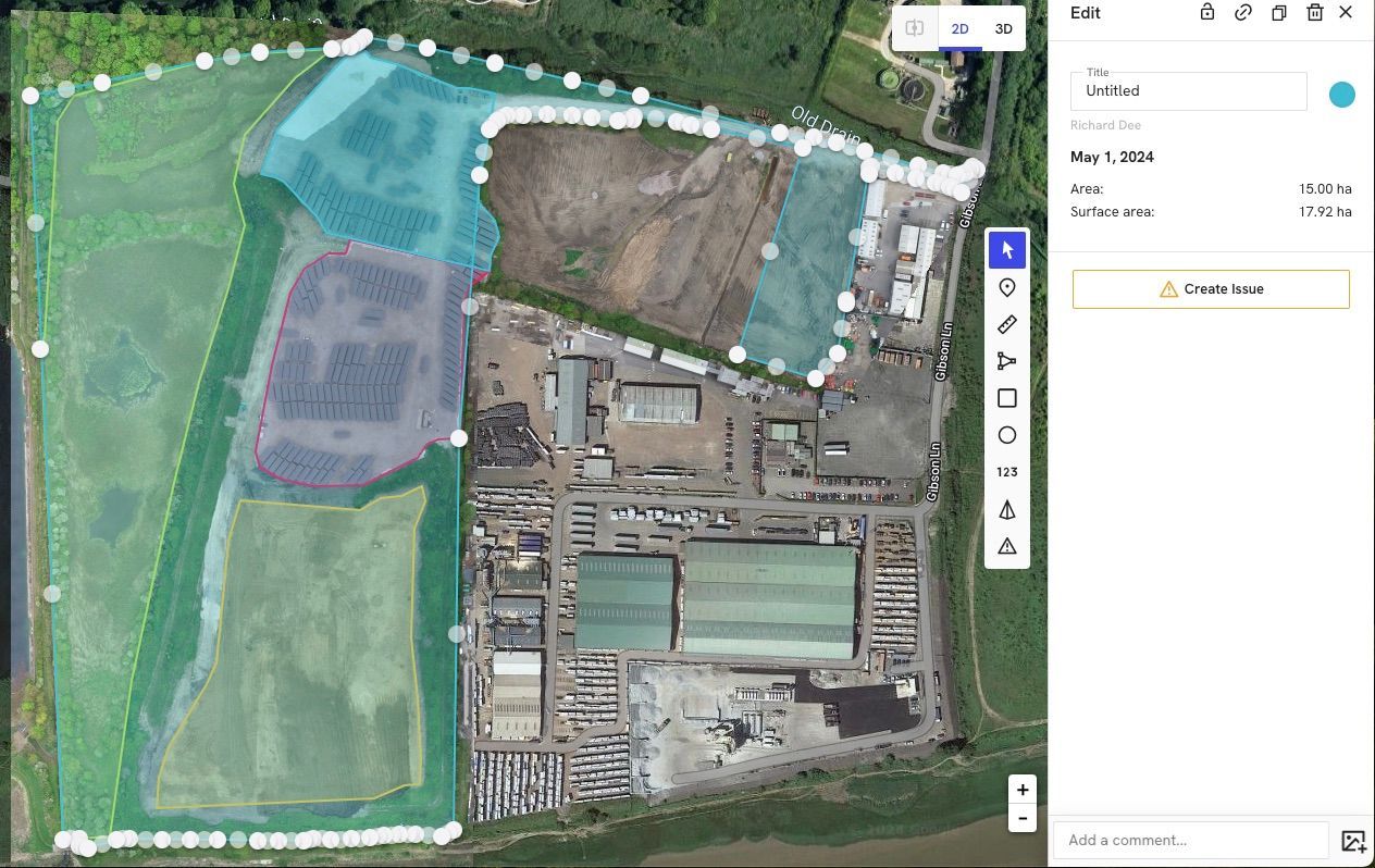
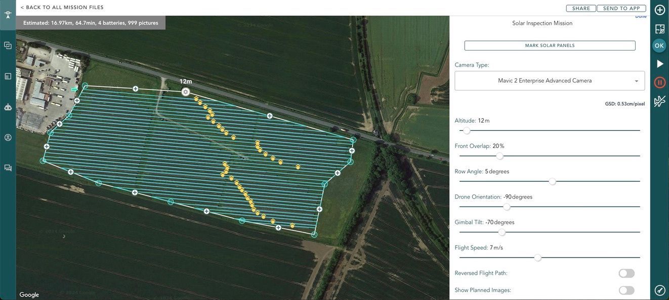
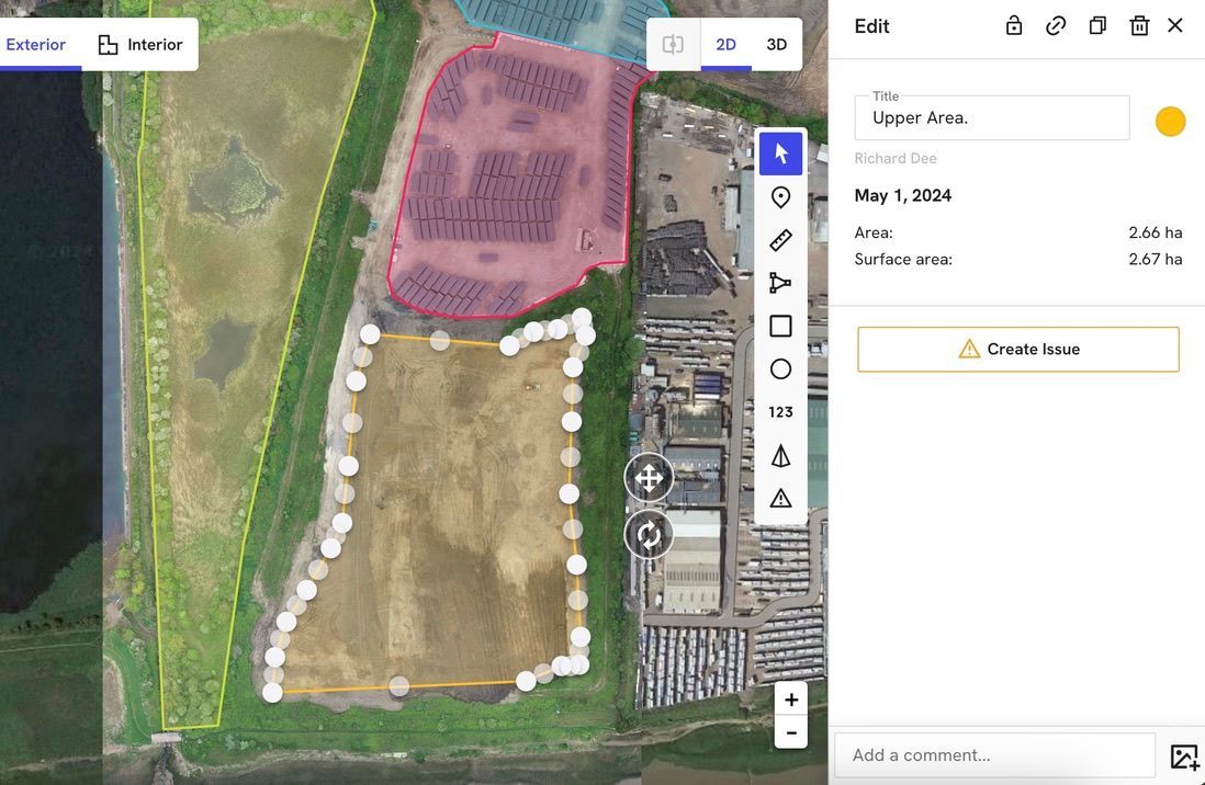
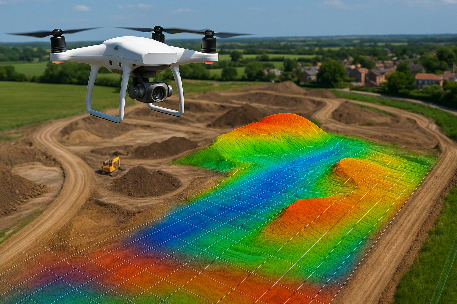
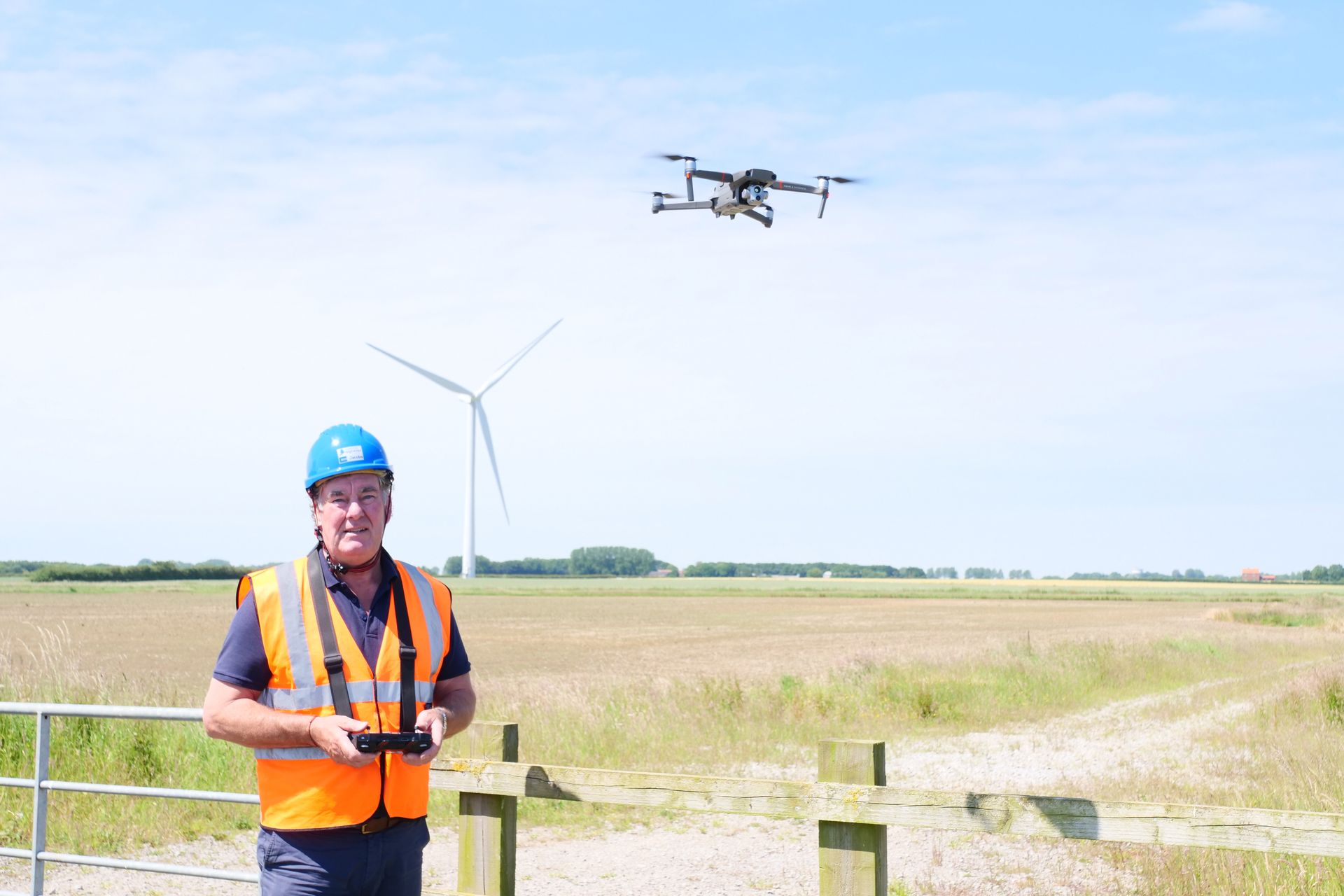
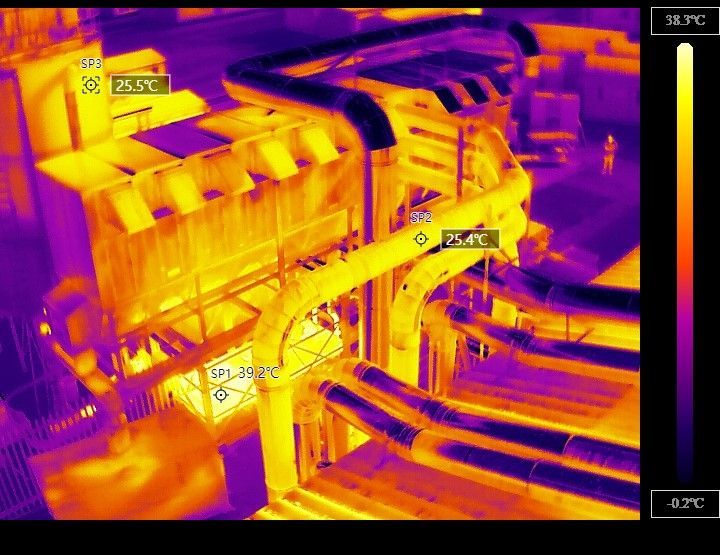
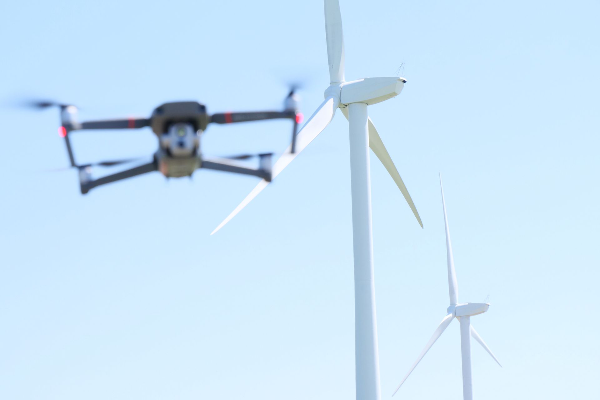
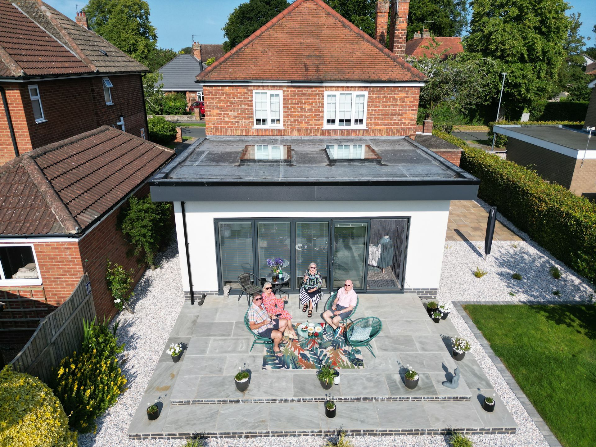
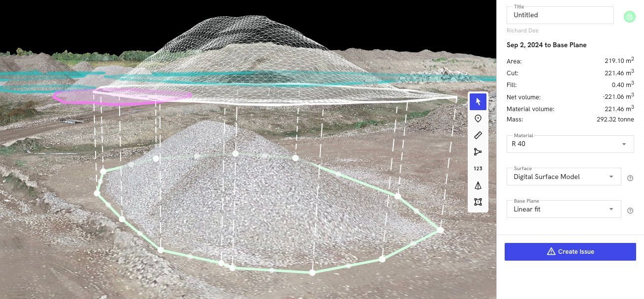
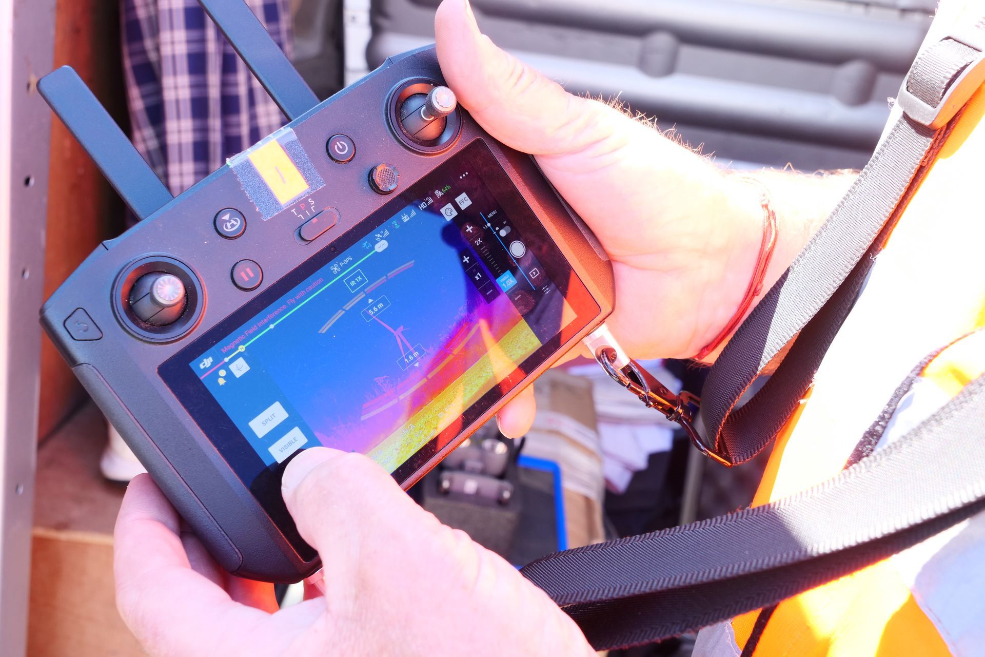
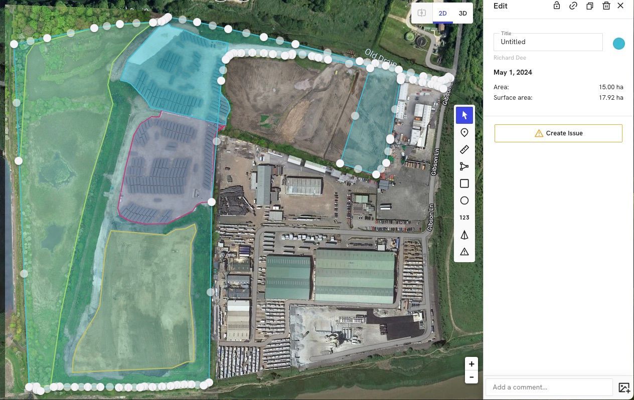
Surveying hazardous environments presents significant challenges for Yorkshire businesses. Traditional methods often expose personnel to unnecessary risks while delivering limited data. This comprehensive guide explores how drone technology is transforming surveying approaches for dangerous locations, providing safer, more effective solutions across multiple industries. Understanding Hazardous Environment Challenges Various environments present unique hazards that complicate traditional surveying approaches: Height-Related Hazards Tall structures, steep terrain, and elevated installations create fall risks that consistently rank among the most dangerous workplace scenarios. Traditional surveys of these environments typically require: Scaffolding or temporary platforms Rope access techniques Mobile elevated work platforms Climbing equipment and harnesses Each of these approaches introduces significant safety risks despite best practices and protective equipment. Structurally Compromised Areas Buildings or structures damaged by fire, flooding, subsidence, or deterioration present unpredictable hazards. Traditional surveys might require: Temporary shoring or supports Protective equipment Multiple personnel for safety monitoring Limited time in high-risk zones These constraints often result in incomplete data collection and continued uncertainty about actual conditions. Contaminated Sites Former industrial sites, chemical storage areas, or locations with hazardous materials present exposure risks. Traditional surveys typically require: Specialised protective equipment Decontamination procedures Limited exposure durations Health monitoring These requirements significantly increase costs while potentially limiting survey comprehensiveness. Confined Spaces Tanks, vessels, tunnels, and other confined spaces present multiple hazards including: Limited oxygen or hazardous atmospheres Restricted entry/exit points Poor visibility Communication challenges Traditional confined space entry requires extensive safety protocols that are both time-consuming and inherently risky despite precautions. Drone Technology as a Safety Solution Aerial survey technology offers a transformative approach to these challenges by fundamentally changing how data is collected: Remote Operation Principle The core safety advantage of drone surveys is simple but powerful: the technology places an unmanned vehicle in hazardous environments while keeping personnel safely removed from danger. Comprehensive Data Collection Modern drone systems capture multiple data types simultaneously: High-resolution visual imagery Thermal signatures Three-dimensional measurements Gas concentrations (with specialised sensors) Structural details from multiple angles This comprehensive approach often delivers more complete information than traditional methods while eliminating direct human exposure to hazards. Industry-Specific Applications in Yorkshire Industrial Facility Inspection Yorkshire's industrial sector benefits from safer inspection approaches for: Chemical Storage Facilities Drone surveys can inspect tank farms, containment areas, and processing equipment without exposing personnel to chemical hazards or requiring facility shutdown. High-Temperature Environments Furnaces, kilns, and heat-intensive processing areas can be inspected while operational, with thermal cameras documenting temperature patterns without human exposure to extreme heat. Elevated Structures Cooling towers, chimneys, flare stacks, and other tall industrial structures can be thoroughly documented without climbing or scaffolding requirements. Confined Processing Vessels Internal inspections of tanks and vessels can often be conducted with specialised confined-space drones, eliminating confined space entry risks. Construction and Demolition The construction sector faces numerous hazardous surveying scenarios: Partially Demolished Structures Buildings in the demolition process present unpredictable structural hazards. Drone surveys can document current conditions without requiring personnel to enter unstable areas. Fire-Damaged Buildings After fires, structural integrity is often uncertain. Aerial surveys provide comprehensive documentation without exposing surveyors to collapse risks. Tall Structures Under Construction Incomplete buildings present fall hazards and often lack proper access points. Drones can document construction progress and identify issues without requiring climbing or temporary access platforms. Contaminated Redevelopment Sites Former industrial sites may contain hazardous materials. Drone surveys can map these sites comprehensively before personnel need to access potentially contaminated areas. Quarry and Mining Operations Extraction industries present some of the most challenging survey environments: High Wall Inspection Quarry faces and excavation walls present significant fall and rockfall hazards. Drone surveys can document these vertical surfaces in detail without requiring personnel to approach unstable edges. Stockpile Measurement Climbing material stockpiles presents engulfment and fall risks. Drone surveys can accurately measure volumes without requiring physical access to these unstable surfaces. Blast Area Assessment Post-blast surveys traditionally required personnel to enter areas with potential undetonated explosives or unstable material. Drones can document blast results immediately without these risks. Abandoned Mine Features Historic mining areas often contain unmarked shafts, unstable ground, or partially collapsed features. Aerial surveys can identify and document these hazards before ground teams need to access the area. Infrastructure Assessment Yorkshire's infrastructure presents numerous hazardous inspection scenarios: Bridge Structures Traditional bridge inspections often require lane closures, under-bridge access equipment, or rope access techniques. Drone surveys can document most bridge elements without these requirements. High-Voltage Installations Electrical infrastructure presents electrocution risks. Drones can inspect transmission lines, substations, and transformers while equipment remains energised and without requiring proximity to high-voltage components. Water Infrastructure Reservoirs, water towers, and treatment facilities present drowning, fall, and confined space risks. Aerial surveys can inspect these structures without requiring direct access to hazardous areas. Railway Infrastructure Track inspections traditionally expose personnel to train strike risks. Drone surveys can document track conditions, signals, and overhead lines without requiring track access or possessions. The Safe Survey Process Effective hazardous environment surveys follow a structured approach: Risk Assessment and Planning Before any survey: Specific hazards are identified and documented Survey objectives are clearly defined Appropriate drone technology is selected Flight paths are planned to maximise data collection while maintaining safety Emergency procedures are established This planning phase ensures the survey delivers required information while minimising any residual risks. Remote Deployment During the survey: Drones are operated from safe locations away from hazards Real-time video feeds allow operators to assess conditions as they're discovered Flight parameters can be adjusted based on findings Multiple passes may capture different data types or perspectives Operations can be paused or modified if unexpected hazards are identified This flexible approach ensures comprehensive data collection while maintaining safety margins. Data Processing and Analysis After the survey: Collected imagery is processed into usable formats (orthomosaics, 3D models, etc.) Measurements and calculations are performed remotely Multiple specialists can review the same data without repeated hazard exposure Findings are documented for future reference Recommendations are developed based on comprehensive information This thorough analysis phase maximises the value of collected data without additional risk exposure. Complementary Safety Approaches While drone technology significantly reduces risk, comprehensive safety often involves multiple approaches: Ground-Based Remote Sensing Laser scanning, remote cameras, and other technologies can complement aerial data for a complete picture. Robotic Systems Ground-based robots can access areas drones cannot reach, such as interior spaces or areas with overhead obstructions. Limited Personnel Entry When human access is absolutely necessary, drone surveys can identify the safest approach paths and highlight specific hazards before entry. Virtual Reality Integration Survey data can be converted to immersive VR environments, allowing "virtual presence" in hazardous areas for detailed inspection without physical risk. Case Study: Yorkshire Quarry Inspection A Yorkshire quarry operator traditionally required geotechnical engineers to approach quarry faces for stability assessment - a process that exposed personnel to significant rockfall and fall risks. By implementing drone survey services , they: Eliminated the need for personnel to approach unstable edges Increased inspection frequency from quarterly to monthly due to reduced costs Improved documentation quality with comprehensive visual records Identified developing stability issues earlier through more frequent monitoring Reduced inspection costs by approximately 60% This approach not only improved safety but enhanced the quality and frequency of critical geotechnical assessments. Regulatory and Compliance Considerations Safe surveying methods must address various regulatory requirements: Health and Safety Compliance Drone surveys help organisations meet their duty of care obligations by eliminating unnecessary risk exposure while maintaining comprehensive asset monitoring. Work at Height Regulations The Work at Height Regulations 2005 require that work at height is avoided where possible. Drone surveys directly support this hierarchy of control by eliminating the need for elevated access in many scenarios. Confined Space Regulations Confined Spaces Regulations 1997 establish strict requirements for confined space entry. Drone technology often eliminates the need for personnel entry, supporting compliance with these regulations. COMAH and Hazardous Site Regulations Sites with significant hazardous materials must maintain comprehensive monitoring and inspection regimes. Drone surveys support these requirements without exposing personnel to chemical or process hazards. For Yorkshire businesses operating in hazardous environments, drone-based surveying represents not merely a technological advancement but a fundamental safety improvement. By removing personnel from dangerous situations while delivering superior data, these methods transform the risk-benefit equation of essential inspection activities. As technology continues to evolve, the capabilities of remote inspection systems will further expand, enabling even more comprehensive hazard avoidance. Forward-thinking organisations are already incorporating these safe surveying methods into their standard procedures, recognising that personnel safety and data quality need not be competing priorities. Whether you're managing industrial facilities, overseeing construction projects, operating extraction sites, or maintaining critical infrastructure, drone survey technology offers a safer, more effective approach to gathering the information you need for confident decision-making in hazardous environments.