5 Ways Drone Surveys Are Transforming Quarry Management
Are you still climbing stockpiles with a clipboard?
There's a better way to manage your quarry.
In this blog, we'll explore how drone technology is revolutionising the quarrying industry, making operations safer, more efficient, and more profitable.
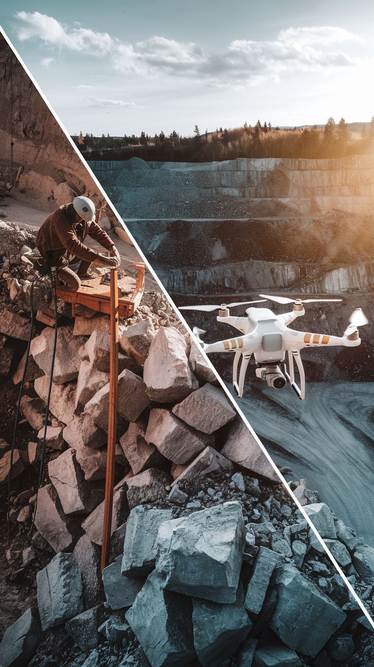
1. Safety First: Keep Your Team's Feet on the Ground
• Traditional method: Climbing stockpiles and inspecting high walls
• Modern solution: Remote drone surveys from safe ground positions
• Real benefit: Reduced accident risks and better HSE compliance
2. Time Is Money: Faster Surveys, Better Results
• Cut survey time from days to hours
• Get results within 24 hours
• Maintain production during surveys
• Regular monitoring without site disruption
3. Accuracy You Can Bank On
• Precise stockpile measurements
• Consistent volume calculations
• Better inventory management
• Accurate financial reporting
4. Smart Planning Made Simple
• Track extraction progress
• Monitor restoration compliance
• Plan future operations
• Document site changes
5. Cost-Effective Operations
• Reduce survey expenses
• Minimise production interruptions
• Better resource allocation
• Improved audit trails
Industry Insight: "The quarrying sector is embracing drone technology because it simply makes business sense. Monthly surveys that once required site shutdowns can now happen during normal operations." - Richard Dee, Dee4Drones
Pro Tips for Getting Started:
✓ Start with a trial survey
✓ Compare results with current methods
✓ Check surveyor qualifications
✓ Ensure CAA compliance
Common Questions Answered:
Q: How often should I survey my quarry?
A: Most quarry operators benefit from monthly surveys for accurate stock control. However, we recommend:
• Monthly surveys for active extraction areas
• Quarterly surveys for overall site monitoring
• Additional surveys after significant weather events
· Custom schedules to match your reporting periods
Q: What weather conditions affect drone surveys?
A: While our drones are highly capable, we follow strict safety guidelines:
• We can fly in light rain and winds up to 15mph
• Best results come from dry conditions
• We avoid heavy rain and strong winds
• Early mornings often offer optimal conditions
• We'll always schedule around weather for best results
Q: How accurate are the measurements?
A: Our drone surveys deliver exceptional accuracy:
• Volumetric calculations within 1-2% accuracy
• Ground sampling resolution down to 1cm/pixel
• 3D models accurate to within 20-30mm
• RTK/PPK technology for survey-grade results
• All results verified against ground control points
Q: What format do I get the data in?
A: We provide data in multiple formats to suit your needs:
• PDF reports with volume calculations
• CAD-compatible files (.dwg, .dxf)
• 3D models and orthomosaic maps
• Excel spreadsheets for quantities
• Cloud-based access to all your surveys
• Raw data available on request
Ready to Modernise Your Quarry Operations?
Book a free consultation with our CAA-licensed pilot or click here to learn more. We'll show you exactly how drone surveys can work for your site.
Contact richard@dee4Ddrones.co.uk 📱 07476 557933