Map Your Site in Minutes, Not Days: How Drone Technology Transforms Data Collection

Richard Dee • January 30, 2025

Map Your Site in Minutes, Not Days: How Drone Technology Transforms Data Collection


Section 1: The Problem with Traditional Data Collection

Collecting data the old-fashioned way can be a real headache.


Many businesses rely on manual methods that are slow and prone to errors. Whether it's measuring a construction site or calculating the tonnage of materials, these traditional techniques often lead to delays and inaccuracies.


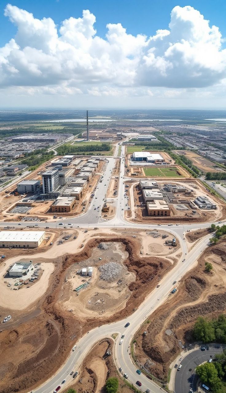
Imagine trying to gather data from a large quarry using just a tape measure or basic tools. It takes ages, and there's always a risk of missing something important.


These outdated methods can hold back your projects and cost you time and money, especially when you need to forecast the number of lorries required to transport materials off-site.


Section 2: How Drone Technology Transforms Data Collection

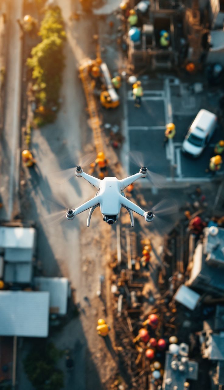
Enter drone technology, the game-changer for data collection.


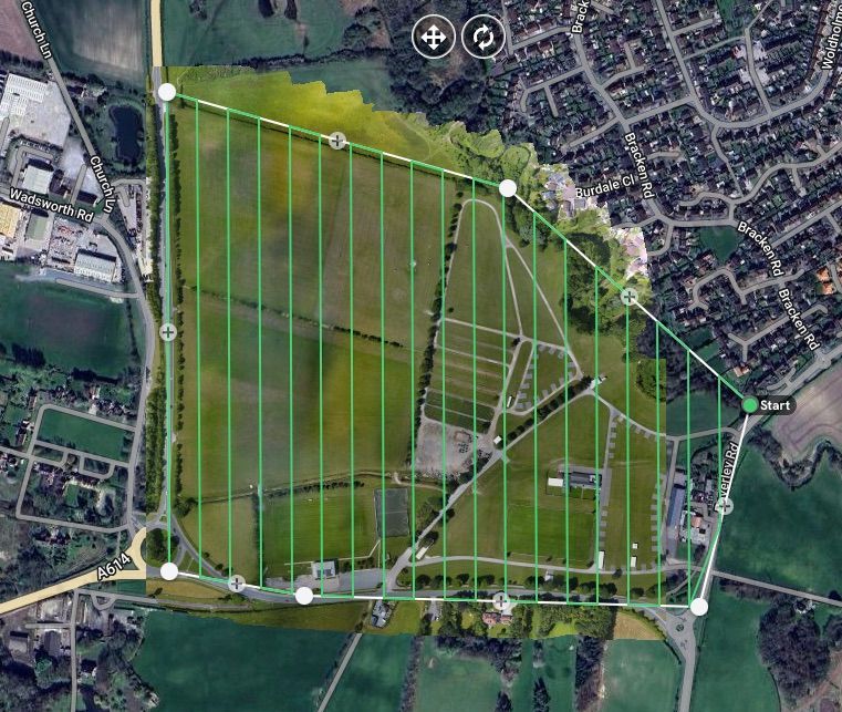
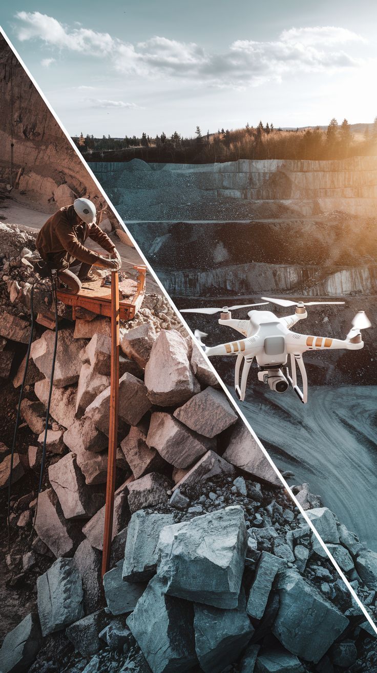
Drones can gather data much faster and more accurately than traditional methods. They fly over your site, capturing detailed images and measurements in a fraction of the time it would take manually.


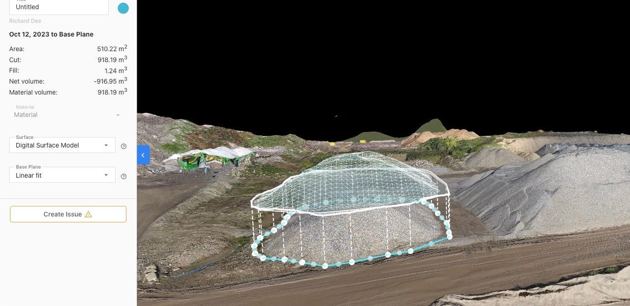
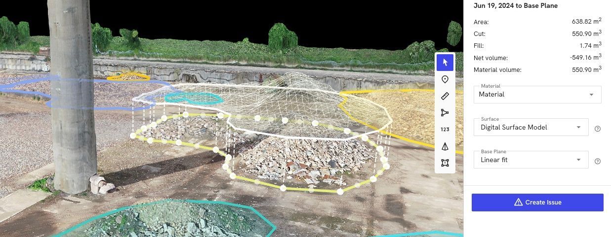
For example, when it comes to quantity surveying of aggregates or calculating the tonnage of materials, drones provide precise data that helps you plan efficiently. This means you can forecast the number of lorries needed to transport materials off-site with confidence and audit materials to ensure adequacy for works to complete.


Using drones not only saves time but also reduces the risk of human error. Plus, they can access hard-to-reach areas safely, keeping your team out of harm's way.


Section 3: Actual Applications and Success Stories

Drones are making a big impact across various industries, and the results speak for themselves.


In construction, drones help track progress and ensure projects stay on schedule. They provide accurate data for quantity surveying, which is crucial for planning and resource management.


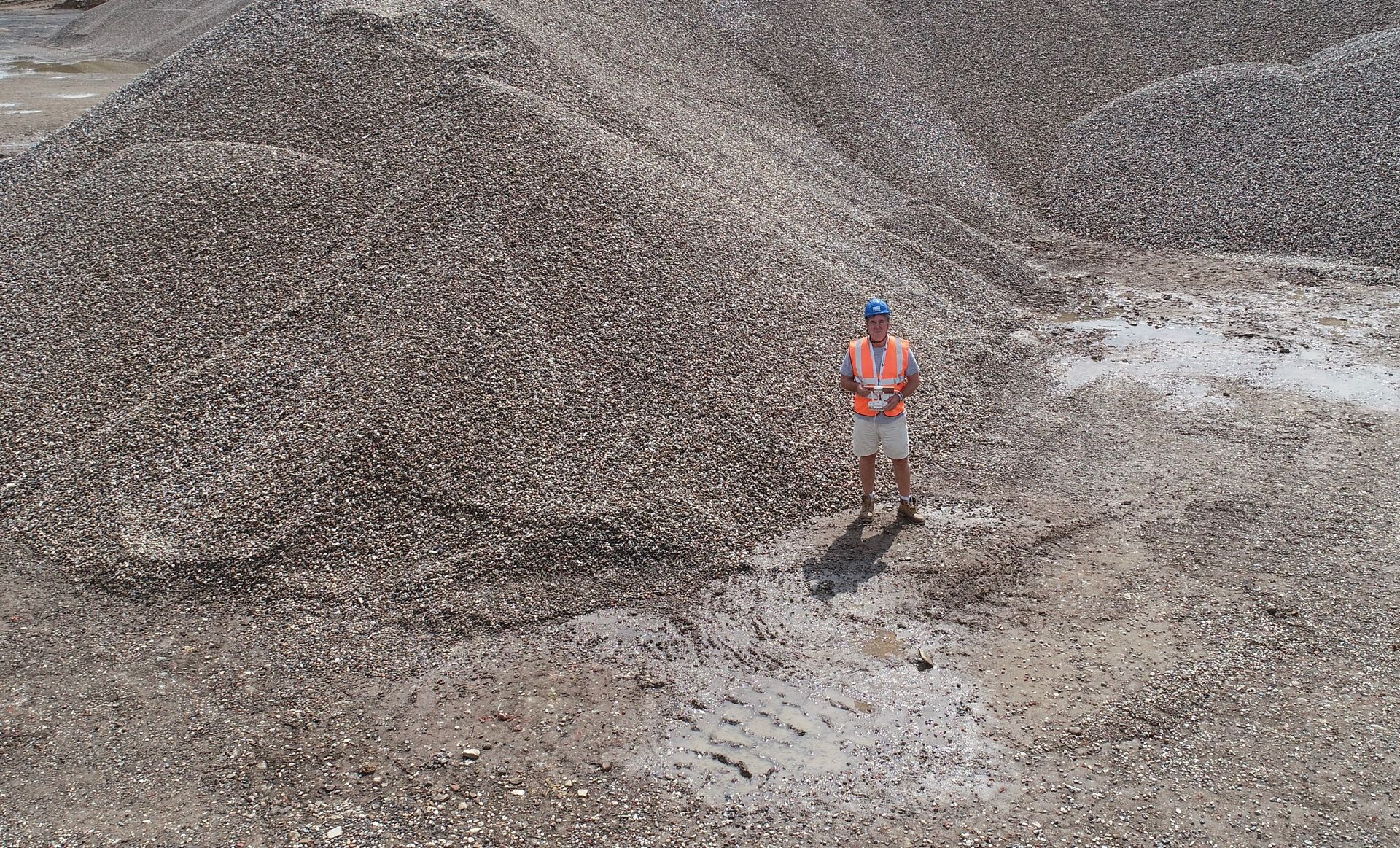
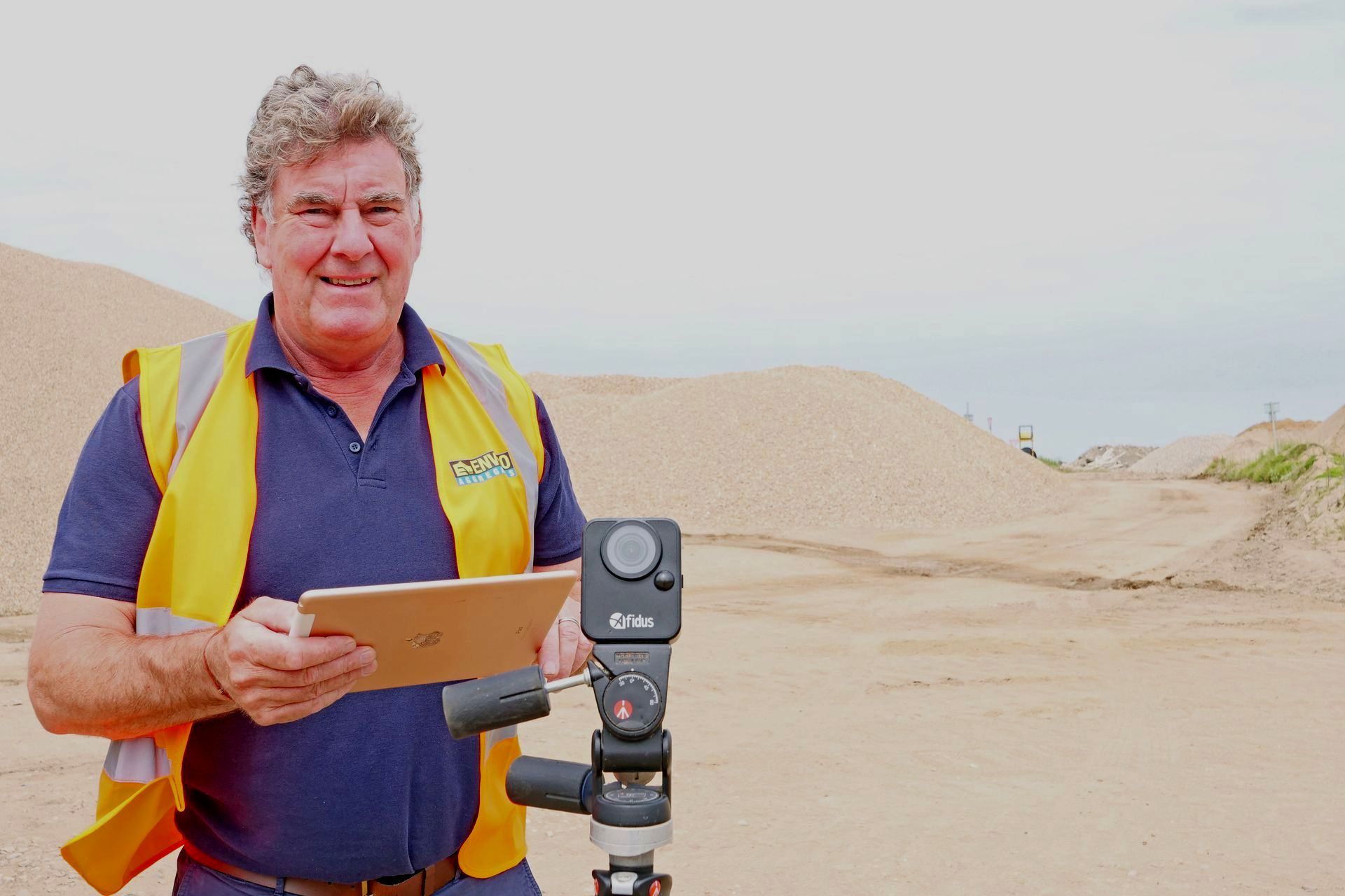
Take, for instance, a recent project where Dee4Drones assisted a quarry operator. By using drones, they accurately calculated the tonnage of materials, ensuring the right number of lorries were scheduled for transport. Quarry management have now embraced the value of drone technology and receive monthly surveys for audit purposes. This not only saved time but also reduced costs and improved efficiency.


These success stories show the practical value of drone technology. Businesses can rely on drones to deliver precise data, helping them make informed decisions and achieve better outcomes.


Section 4: Why Choose Dee4Drones for Your Data Collection Needs

When it comes to drone data collection, Dee4Drones stands out as a trusted partner.


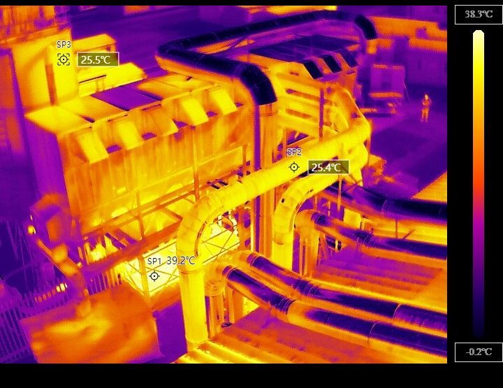
With years of experience and a strong track record, we offer services that address your specific challenges. Our team is fully qualified, holding a GVC Civil Aviation Authority (CAA) licence, a TQUK Level 5 Award for Commercial Drone Chief Pilots, and a Category 1 Thermographer certification.


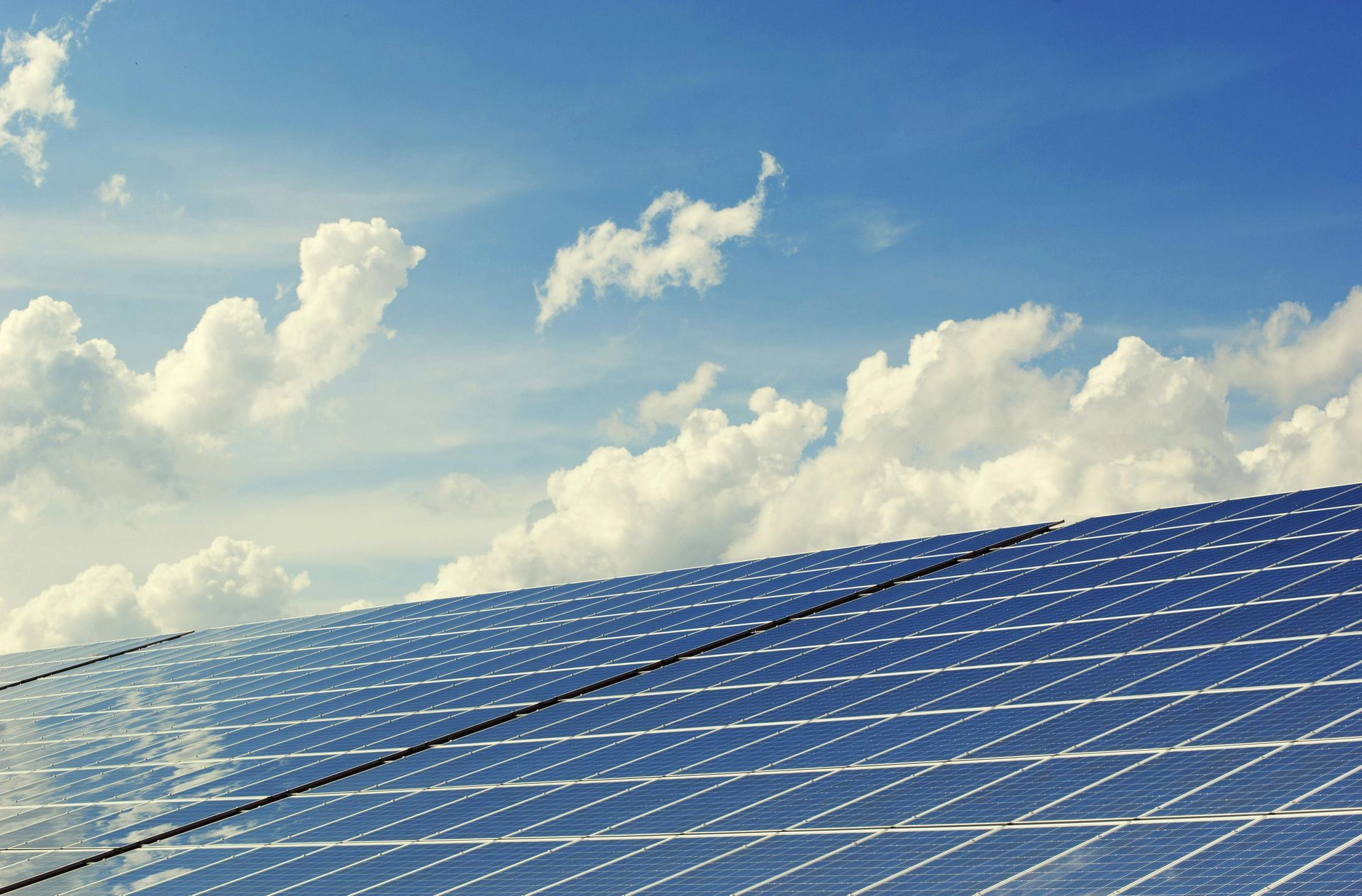
We specialise in providing accurate and timely data, whether it's for construction, quarry management, or renewable energy projects. Our drones deliver precise measurements and detailed images, helping you make informed decisions and keep your projects on track.


Choosing Dee4Drones means choosing expertise and reliability. We understand the importance of getting the right data quickly and safely, and we're here to help you achieve your goals.


Conclusion

In this blog, we've explored how drone technology can revolutionise your data collection process.

You've learned about the challenges of traditional methods and how drones offer a faster, more accurate solution. We've shared actual success stories, showing the practical benefits of using drones for tasks like quantity surveying and monthly audits.


By choosing Dee4Drones, you gain a partner with the expertise and qualifications to meet your data needs efficiently and safely.


Ready to transform your data collection?


Contact us today to discuss how our drone services can benefit your business. 


Email richard@dee4drones.co.uk or call us on 07476 557933 to get started.


By Richard Dee February 10, 2025
Overcome Monitoring Challenges with Drone Technology for Large Sites Introduction Have you ever found it challenging to keep track of everything happening on a large site? Whether it's a construction project, a quarry, or a renewable energy installation, monitoring these vast and complex areas can be tough. Traditional methods often fall short, leaving you with gaps in information and potential safety risks. But what if there was a way to see everything clearly and in real-time? In this post, we'll explore how drone technology can transform site monitoring, making it easier, safer, and more efficient. You'll learn about the challenges of monitoring large sites, how drones can help, and the real benefits they bring. Understanding the Challenges Monitoring large and complex sites isn't just about keeping an eye on things. It's about ensuring safety, tracking progress, and managing resources effectively. But with traditional methods, you might face several hurdles: Limited Visibility: It's hard to see everything from the ground, especially in areas that are hard to reach. Time-Consuming Processes: Walking the site or using manual methods can take a lot of time and effort. Safety Risks: Inspecting dangerous areas can put your team at risk. Data Gaps: Without real-time information, you might miss important changes or issues. These challenges can lead to delays, increased costs, and even safety incidents. But there's a better way to handle them. How Drones Make a Difference Drones are changing the game when it comes to monitoring large sites. Here's how they can help: Aerial Views: Drones provide a bird's-eye view of your site, allowing you to see everything clearly, even in hard-to-reach areas. Real-Time Data: With drones, you can collect data instantly, helping you spot issues as they arise. Safety First: Drones can inspect dangerous areas without putting your team at risk, ensuring safety compliance. Efficiency Boost: By reducing the time and effort needed for site inspections, drones help you save time and resources. These features make drones an excellent tool for overcoming the challenges of monitoring large and complex sites. Practical Applications Drones aren't just a fancy gadget; they're a practical tool used across various industries. Here's how different sectors are benefiting: Construction: Drones help track progress, measure quantities, and document milestones, ensuring projects stay on schedule. Quarry and Mining: By inspecting dangerous areas, drones provide safety compliance data and volume calculations without risking human safety. Green Energy: Drones perform solar panel efficiency checks and wind turbine inspections, helping optimise performance and plan installations. These examples show how drones can be tailored to meet the specific needs of different industries, making them a versatile solution for site monitoring. Measurable Benefits Using drones for site monitoring isn't just about convenience; it's about real, measurable benefits: Time Savings: Drones can map a site in minutes, not days, freeing up your team to focus on other tasks. Improved Safety: By reducing the need for manual inspections in dangerous areas, drones help lower the risk of accidents. Cost Efficiency: With faster data collection and fewer safety incidents, drones can help reduce overall project costs. Better Decision-Making: Real-time data allows you to make informed decisions quickly, keeping your project on track. Accurate Audits: Drones provide precise data and detailed imagery, ensuring your audits are thorough and reliable. This accuracy helps in compliance and quality control, giving you peace of mind. These benefits show how drones can make a significant impact on your operations, helping you manage large and complex sites more effectively. Conclusion Monitoring large and complex sites doesn't have to be a daunting task. With drone technology, you can overcome the challenges of limited visibility, safety risks, and time-consuming processes. Drones offer a clear view, real-time data, and accurate audits, making site management more efficient and effective.  Ready to transform how you monitor your site? Contact Dee4Drones today for a consultation or demo. Let us show you how our drone solutions can make a difference for your business. Visit our website at www.dee4drones.co.uk or call us at 07476 557933 to get started.
By Richard Dee February 9, 2025
Aerial Surveys: A Comprehensive Guide Introduction  Aerial surveys are transforming how businesses gather information. By using drones, you can capture detailed images and data from above, offering a clear view of large areas. This guide explores the benefits of aerial surveys, the technology involved, and the importance of working with qualified professionals. What Are Aerial Surveys? Aerial surveys use drones to capture images and data from above. They are used in various fields, such as construction, agriculture, and mining. Drones provide a bird's-eye view, making it easier to track progress, measure land, and spot problems early. Thermography is a special type of aerial survey that uses thermal cameras to detect heat variations. It's useful for roof surveys, identifying heat loss, and finding faults in machinery. Aerial surveys are particularly beneficial in highly populated and high-risk areas, like near railway lines and airports. Drones can safely gather data without disrupting these environments. Key Technical Aspects of Aerial Surveys Equipment Used: Aerial surveys rely on drones equipped with specialised cameras. These drones are designed to capture high-quality images and videos from above, providing a detailed view of the area. Many drones are fitted with thermal cameras for detecting heat variations. This is particularly useful for identifying heat loss in roofs and assessing property infrastructure. By spotting these issues early, businesses can address them before they become costly problems. The choice of drone and camera depends on the specific needs of the survey, ensuring the best results for each project. Data Collection: Drones fly over the area, collecting images and videos that show the site's current state. This data helps in tracking progress and identifying issues. Data Processing: Special software processes the collected data into useful information, such as 3D maps and thermal images. This helps businesses make informed decisions. Importance of Engaging Qualified Drone Pilots Qualified drone pilots have the skills and certifications needed for safe and effective operations. They ensure compliance with regulatory requirements and health and safety standards, especially in high-risk areas. Being fully insured, they provide peace of mind, knowing that any unforeseen incidents are covered. Pitfalls of Using Unqualified Suppliers Using unqualified suppliers can lead to inaccurate data, legal issues, and unexpected costs. They may not follow safety standards or have the necessary insurance, leading to potential financial burdens. Inexperience can also affect the quality of the survey, resulting in poor decision-making. Conclusion Aerial surveys offer a powerful way to gather detailed information for various projects. By understanding the technology and choosing qualified professionals, you can ensure accurate and reliable results. This guide aims to provide you with the knowledge needed to make informed decisions about using aerial surveys in your business.
By Richard Dee February 4, 2025
Are you still climbing stockpiles with a clipboard? There's a better way to manage your quarry. In this blog, we'll explore how drone technology is revolutionising the quarrying industry, making operations safer, more efficient, and more profitable. 1. Safety First: Keep Your Team's Feet on the Ground • Traditional method: Climbing stockpiles and inspecting high walls • Modern solution: Remote drone surveys from safe ground positions • Real benefit: Reduced accident risks and better HSE compliance 2. Time Is Money: Faster Surveys, Better Results • Cut survey time from days to hours • Get results within 24 hours • Maintain production during surveys • Regular monitoring without site disruption 3. Accuracy You Can Bank On • Precise stockpile measurements • Consistent volume calculations • Better inventory management • Accurate financial reporting 4. Smart Planning Made Simple • Track extraction progress • Monitor restoration compliance • Plan future operations • Document site changes 5. Cost-Effective Operations • Reduce survey expenses • Minimise production interruptions • Better resource allocation • Improved audit trails Industry Insight: "The quarrying sector is embracing drone technology because it simply makes business sense. Monthly surveys that once required site shutdowns can now happen during normal operations." - Richard Dee, Dee4Drones Pro Tips for Getting Started: ✓ Start with a trial survey ✓ Compare results with current methods ✓ Check surveyor qualifications ✓ Ensure CAA compliance Common Questions Answered: Q: How often should I survey my quarry? A: Most quarry operators benefit from monthly surveys for accurate stock control. However, we recommend: • Monthly surveys for active extraction areas • Quarterly surveys for overall site monitoring • Additional surveys after significant weather events · Custom schedules to match your reporting periods Q: What weather conditions affect drone surveys? A: While our drones are highly capable, we follow strict safety guidelines: • We can fly in light rain and winds up to 15mph • Best results come from dry conditions • We avoid heavy rain and strong winds • Early mornings often offer optimal conditions • We'll always schedule around weather for best results Q: How accurate are the measurements? A: Our drone surveys deliver exceptional accuracy: • Volumetric calculations within 1-2% accuracy • Ground sampling resolution down to 1cm/pixel • 3D models accurate to within 20-30mm • RTK/PPK technology for survey-grade results • All results verified against ground control points Q: What format do I get the data in? A: We provide data in multiple formats to suit your needs: • PDF reports with volume calculations • CAD-compatible files (.dwg, .dxf) • 3D models and orthomosaic maps • Excel spreadsheets for quantities • Cloud-based access to all your surveys • Raw data available on request Ready to Modernise Your Quarry Operations? Book a free consultation with our CAA-licensed pilot or click here to learn more. We'll show you exactly how drone surveys can work for your site. Contact richard@dee4Ddrones.co.uk 📱 07476 557933
Richard flying a DJI Mavic 2EA in a quarry
By Richard Dee January 30, 2025
Have you ever wondered about the risks involved in traditional surveying methods? From working at great heights to navigating hazardous areas, these methods can pose significant safety concerns for workers and businesses alike. But what if there was a safer way to gather the information you need? Enter Dee4Drones, where we use cutting-edge drone technology to make surveying not only safer but also more efficient. In this blog, we'll explore the safety issues with traditional surveying and how our drones offer a better solution. Understanding Traditional Surveying Methods Traditional surveying methods have been around for a long time. They often involve workers using tools like theodolites and measuring tapes to gather data on-site. While these methods can be effective, they come with their own set of risks. Workers might have to climb ladders, work on scaffolding, or navigate uneven terrain. These activities can lead to accidents, injuries, and even fatalities. The need to physically access dangerous areas means that safety is always a concern. This is why many businesses are looking for safer alternatives to traditional surveying. The Impact of Safety Concerns Safety concerns in traditional surveying can have a big impact on projects. When workers face risks, it can lead to accidents and injuries. This not only affects the well-being of the workers but also causes project delays and increases costs. Imagine a project coming to a halt because of an accident. The downtime can be costly, and the project might miss important deadlines. Additionally, businesses may face higher insurance premiums and potential legal issues. Addressing these safety concerns is crucial for keeping projects on track and within budget. That's why finding a safer way to survey is so important. How Dee4Drones Provides a Safer Solution At Dee4Drones, we offer a safer way to survey using drone technology. Our drones can access areas that are difficult or dangerous for humans to reach, eliminating the need for workers to put themselves at risk. With drones, we can quickly gather data from above, providing a comprehensive view of the site without anyone having to climb ladders or navigate hazardous terrain. This not only reduces the risk of accidents but also speeds up the data collection process. Our drone surveys are not just safer; they are also efficient and accurate. By using drones, you can get the information you need without compromising on safety. Practical Example Let's look at a practical example where Dee4Drones made a difference. A construction company in Yorkshire faced challenges with traditional surveying methods. Workers had to climb scaffolding and work in risky areas, leading to frequent delays and safety concerns. By switching to Dee4Drones, the company saw immediate benefits. Our drones quickly surveyed the site, providing detailed data without putting anyone in harm's way. The project stayed on schedule, and the risk of accidents was significantly reduced. This example shows how using drones can improve safety and efficiency, making them a smart choice for modern surveying needs. Conclusion Traditional surveying methods come with safety risks that can impact both workers and projects. Accidents and delays are common, leading to increased costs and missed deadlines. But with Dee4Drones, you have a safer and more efficient alternative. Our drone technology eliminates the need for workers to enter dangerous areas, providing quick and accurate data collection. By choosing Dee4Drones, you can keep your projects on track while ensuring the safety of your team. Ready to make your surveying safer and more efficient? For more information on aerial surveys contact Dee4Drones today on 07476 557933 . Let us help you take the next step towards safer surveying.
By Richard Dee January 30, 2025
Timely Delivery of Survey Results Have you ever found yourself waiting for survey results that seem to take forever? Delays can throw a spanner in the works, causing project hold-ups and unexpected costs. At Dee4Drones, we understand the importance of getting your survey results on time. In this post, we'll show you how we ensure timely delivery, keeping your projects on track and your stress levels low. The Importance of Timely Survey Results Getting survey results on time is more than just a convenience, it's a necessity for businesses. When results are delayed, it can lead to project setbacks and increased costs. Imagine planning a construction project and having to pause because the survey data isn't ready. This not only wastes time but also affects your budget and resources. Timely survey results help you make informed decisions, keep your projects on schedule, and avoid unnecessary expenses. How Dee4Drones Ensures Timely Delivery At Dee4Drones, we pride ourselves on delivering survey results when you need them. Our advanced drone technology allows us to collect data quickly and accurately. We use efficient processes to analyse this data, ensuring you get the information you need without delay. Our team of experts is experienced in managing tight schedules, so you can trust us to keep your projects moving forward. Benefits of Choosing Dee4Drones for Your Surveys When you choose Dee4Drones, you're choosing reliability and efficiency. Our timely survey results mean fewer project delays and better decision-making. Clients often tell us how our quick turnaround has helped them stay on track and within budget. With our proven track record, you can count on us to deliver the results you need, when you need them. In this post, we've explored why timely survey results are crucial for your projects. We've shown how Dee4Drones ensures you get your results on time, helping you avoid delays and make informed decisions. With our reliable service, you can keep your projects on track and your stress levels low. Ready to experience the benefits of timely survey results? Get in touch with us today to learn more or to book your survey. Contact us on 07476 557933 or click here to learn more.
By Richard Dee January 30, 2025
Lack of Visual Data to Support Decision-Making Introduction Have you ever found yourself stuck making a decision because you just didn't have the right information? In today's fast-paced world, having the right data at your fingertips is more important than ever. Without visual data, making informed decisions can feel like trying to solve a puzzle with missing pieces. At Dee4Drones, we understand the struggle. That's why we offer solutions that turn complex data into clear, visual insights. Whether you're in construction, agriculture, or renewable energy, our drone technology can help you see the bigger picture. The Importance of Visual Data Visual data is like having a map when you're lost. It guides you and helps you make the right choices. In many industries, from construction to agriculture, visual data is key. It helps you see what's happening on the ground, track progress, and spot problems early. Imagine trying to manage a large construction site without seeing it from above. You might miss important details that could lead to costly mistakes. With visual data, you get a clear view of your projects, making it easier to plan, monitor, and make decisions. Challenges Without Visual Data Without visual data, making decisions can be like flying blind. Businesses often face several challenges when they lack this crucial information. For instance, construction firms might struggle to track progress accurately, leading to delays and increased costs. In agriculture, farmers might miss signs of crop issues, affecting yield and profits. Consider the impact of flooding. Without aerial views, it can be difficult to assess the extent of flood damage quickly. This delay can lead to slower response times, increased damage, and higher recovery costs. Without a clear view, it's easy to overlook problems until they become big issues. This can lead to poor decision-making, wasted resources, and missed opportunities. Visual data helps you avoid these pitfalls by providing the insights you need to act quickly and confidently. How Dee4Drones Provides Solutions At Dee4Drones, we turn complex data into clear, visual insights that help you make better decisions. Our aerial surveys and 3D mapping services give you a bird's-eye view of your projects. Whether you're managing a construction site, monitoring crops, or assessing flood damage, our drones capture detailed images that reveal the full picture. For construction firms, our surveys help track progress, measure quantities, and monitor changes. In agriculture, we provide crop monitoring and land surveys to help farmers optimise their operations. When it comes to flooding, our drones can quickly assess the surface area impacted. This helps you understand the extent of crop damage and identify accessibility issues on site. With this information, you can plan a faster and more effective response. With Dee4Drones, you get the visual data you need to make informed decisions and keep your projects on track. Benefits of Using Dee4Drones Choosing Dee4Drones means gaining a clear advantage in your decision-making process. With our visual data, you can improve accuracy and efficiency across your projects. For example, construction firms can avoid costly mistakes by having up-to-date site information. Farmers can boost their yields by spotting crop issues early. In the case of flooding, having detailed aerial images allows for quicker assessment and response. This means less downtime and reduced recovery costs. One of our clients, a large agricultural business, used our drone services to assess flood damage. They were able to quickly identify affected areas and plan their recovery, saving time and resources. With Dee4Drones, you not only get the data you need but also the confidence to make the right decisions. Conclusion In this blog post, we've explored the importance of visual data in making informed decisions. We've seen how the lack of such data can lead to challenges, from construction delays to crop damage due to flooding. Dee4Drones offers solutions that provide the clear, visual insights you need. Our aerial surveys and 3D mapping services help you track progress, assess damage, and make confident decisions.  Don't let the lack of visual data hold you back. Reach out to Dee4Drones today and discover how our services can support your business. Contact us at 07476 557933 or visit our website at www.dee4drones.co.uk to learn more about how we can help you make better decisions with visual data.
By Richard Dee January 30, 2025
7 Reasons to Choose Dee4Drones for Your Aerial Needs Have you ever wondered how to choose the right drone service for your business needs? With so many options out there, it can be a bit overwhelming. But don't worry, we're here to help! At Dee4Drones, we make complex drone technology simple and effective for businesses across the UK. Whether you need aerial surveys, safety inspections, or roof inspections with thermography for heat loss and solar panel fault identification, we've got you covered. Reason 1: Expertise and Experience When it comes to drone services, experience matters. Richard Dee, the founder of Dee4Drones, has been in the business since 2013. With a GVC Civil Aviation Authority (CAA) licence, a TQUK Level 5 Award for Commercial Drone Chief Pilots, and a Category 1 Thermographer qualification, Richard brings a wealth of knowledge to every project. This expertise ensures that your aerial needs are met with precision and professionalism. Whether it's a complex survey or a detailed inspection, you can trust that you're in capable hands. Reason 2: Comprehensive Services At Dee4Drones, we offer a wide range of services to meet your business needs. Our core offerings include aerial surveys, safety inspections, and roof inspections with thermography for heat loss and solar panel fault identification. These services are designed to help you track progress, ensure safety compliance, and identify potential issues before they become costly problems. Whatever your aerial needs, we have the expertise and technology to deliver results. Reason 3: Safety and Compliance Safety is a top priority at Dee4Drones. We understand the importance of operating within the guidelines set by the Civil Aviation Authority (CAA) to ensure safe and compliant drone operations. Our commitment to safety means you can trust us to handle your projects with care and precision. We conduct thorough risk assessments and follow strict protocols to minimise any potential hazards, giving you peace of mind. Reason 4: Advanced Technology At Dee4Drones, we use the latest drone technology to provide high-quality services. Our drones are equipped with advanced cameras and sensors, allowing us to capture detailed images and data. This technology enables us to deliver precise aerial surveys, accurate inspections, and comprehensive reports. By using cutting-edge equipment, we ensure that you receive the best possible results for your projects. Reason 5: Customer-Centric Approach At Dee4Drones, we put our customers first. We understand that every project is unique, and we tailor our services to meet your specific needs. Our personalised approach ensures that you receive the attention and detail you deserve. We pride ourselves on building strong relationships with our clients. By listening to your requirements and providing clear communication, we make sure that your experience with us is smooth and satisfying. Reason 6: Proven Track Record Dee4Drones has a history of successful projects and satisfied clients. Our proven track record speaks for itself, with numerous businesses across the UK trusting us for their aerial needs. We've helped construction firms track progress, estate agents showcase properties, and renewable energy developers monitor installations. Our clients consistently achieve positive outcomes, thanks to our reliable and effective services. Reason 7: Local Knowledge Being based in the UK gives Dee4Drones a unique advantage. We understand the local landscape, regulations, and business environment, which allows us to provide services that are tailored to the needs of our clients. Our local knowledge means we can offer insights and solutions that others might miss. Whether you're in Yorkshire or anywhere else in the UK, you can count on us to deliver services that are both relevant and effective. Choosing the right drone service can make a big difference for your business. With Dee4Drones, you benefit from our expertise, comprehensive services, and commitment to safety. Our advanced technology and customer-centric approach ensure you get the best results. We've built a strong track record and have the local knowledge to meet your needs effectively. Whether it's aerial surveys, safety inspections, or roof inspections with thermography, Dee4Drones is your trusted partner in the UK. Ready to see how Dee4Drones can help your business? Contact us today to discuss your project needs. Visit our aerial survey page to discover more or call us on 07476 557933 .  Let's take your business to new heights together!
Share by: